Hunting in New Brunswick
Maps, boundaries, crown land, regulations, and weather for New Brunswick hunters - all in one app, available offline.
Also on the App Store and Google Play.
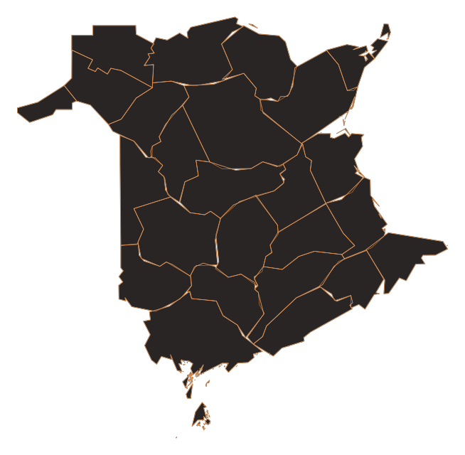
Wildlife Management Zones from provincial open data · synced 2026-08-15 · Tap a unit in the CANhunt app for seasons, regulations and draw zone maps.
How CANhunt helps you hunt in New Brunswick
New Brunswick divides its hunting ground into wildlife management zones (WMZs), and almost every question that matters in the field starts with which one you are standing in. CANhunt draws those boundaries over satellite imagery, so you can see where a line falls on the actual treeline or river rather than on a diagram, and tapping any point names the unit and what is open there.
Crown land is a layer of its own, drawn beside protected areas, parks and the zones closed to hunting, so the ground you may hunt in New Brunswick and the ground you may not are one picture rather than two documents. All of it is available offline: download the part of New Brunswick you are hunting before you leave, and the map, the boundaries and your own spots keep working where there is no signal, which is most of the ground worth hunting.
Offline Maps
Download satellite and topo maps for New Brunswick's hunting zones. Navigate back roads and crown land without cell service.
Boundary Overlays
See WMU boundaries and crown land overlaid on satellite imagery. Know exactly which zone you're in across New Brunswick.
Regulations
New Brunswick hunting seasons, bag limits, and legal requirements - pulled from government data and updated regularly.
HuntIntel
Tap any point in New Brunswick to identify the zone you are standing in, and the LEH draw zones that cover it.
Weather
Hyperlocal weather, wind, and moon phase data for your exact spot in New Brunswick. Plan your sits around conditions.
New Brunswick Hunting Guides
No Shooting Zones in New Brunswick: Where You Can Legally Discharge a Firearm
New Brunswick's firearm discharge rules for hunters — the tiered setback that changes with your weapon (400 m rifle, 200 m muzzleloader, 100 m bow), the highway rule, wildlife refuges and parks, and municipal considerations — plus how to see restricted zones on your map.
Complete Guide to Hunting in New Brunswick
A complete guide to hunting in New Brunswick — covering 28 Wildlife Management Zones, whitetail deer, moose, and bear across the Acadian forest, river valleys, and coastal lowlands.
Crown Land Hunting in New Brunswick: Where to Go
A practical guide to hunting crown land in New Brunswick, covering the 48% crown land base, industrial freehold distinctions, and strategies for accessing the province's forests.
Explore Other Provinces & Territories
Hunting in New Brunswick: common questions
Does CANhunt cover hunting in New Brunswick?
Yes. New Brunswick is one of the thirteen provinces and territories CANhunt covers in full: Wildlife Management Zones (WMZs), the land layers that say where you may hunt, season dates and regulations, and hyperlocal weather, all on one map and all usable offline.
Can I see New Brunswick's Wildlife Management Zones on the map?
Yes. New Brunswick's Wildlife Management Zones are drawn over satellite imagery, so you can see the boundary against the actual ground rather than a diagram. Tap any point and CANhunt names the unit you are standing in and what is open there.
Where can I hunt crown land in New Brunswick?
CANhunt draws New Brunswick's crown land as its own layer, alongside provincial reserves, protected areas, national parks and no-hunting zones, so the ground you may hunt and the ground you may not are the same picture. It works offline once the area is downloaded, which is usually where crown land is.
Does the app work offline in New Brunswick?
Yes. Download the part of New Brunswick you are hunting before you leave, and the map, the boundaries and your saved spots keep working with no signal. That is the point: the places worth hunting in New Brunswick are the places without coverage.
Are New Brunswick hunting seasons and regulations in the app?
Yes. Season dates, bag limits, weapon restrictions and closed areas for New Brunswick come from the province's own published regulations, and they are shown for the unit you are looking at rather than as a document to search.
Does CANhunt show weather for New Brunswick?
Yes. Temperature, wind direction and speed, pressure trend, and sun and moon times for the exact spot you tap in New Brunswick, in New Brunswick's own clock rather than yours.
Start hunting New Brunswick with CANhunt
Download CANhunt free. Offline maps, boundaries, regulations, and weather - built for Canadian hunters.
Also on the App Store and Google Play.